Airport maps and runway incursions
The directory of safety and security for a large airline asked me to take a look at airport runway maps and how runway incursions might be reduced by better maps. This is pro bono work and should be an interesting case study of maps and how they should be designed to produce satisfactory performances in the real world. I hope that Kindly Contributors who know about maps for flying and runways can help with this.
There are obvious issues with map design here, but let’s begin instead with the content side: What goes on at runways? What are the causes of incursions? What are the issues for pilots? What about links between the tower controllers and pilots? What about the links between what the pilot sees out the window and what the runway map shows? How can words, maps, and what is seen out the window provide accurate and consistent guidance–and thereby, one hopes, reduce runway incursions?
I have not yet done any research on this so some tours of Google would be useful.
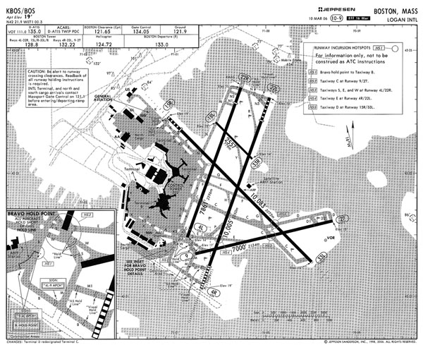
Here’s a map for Boston’s Logan Airport: